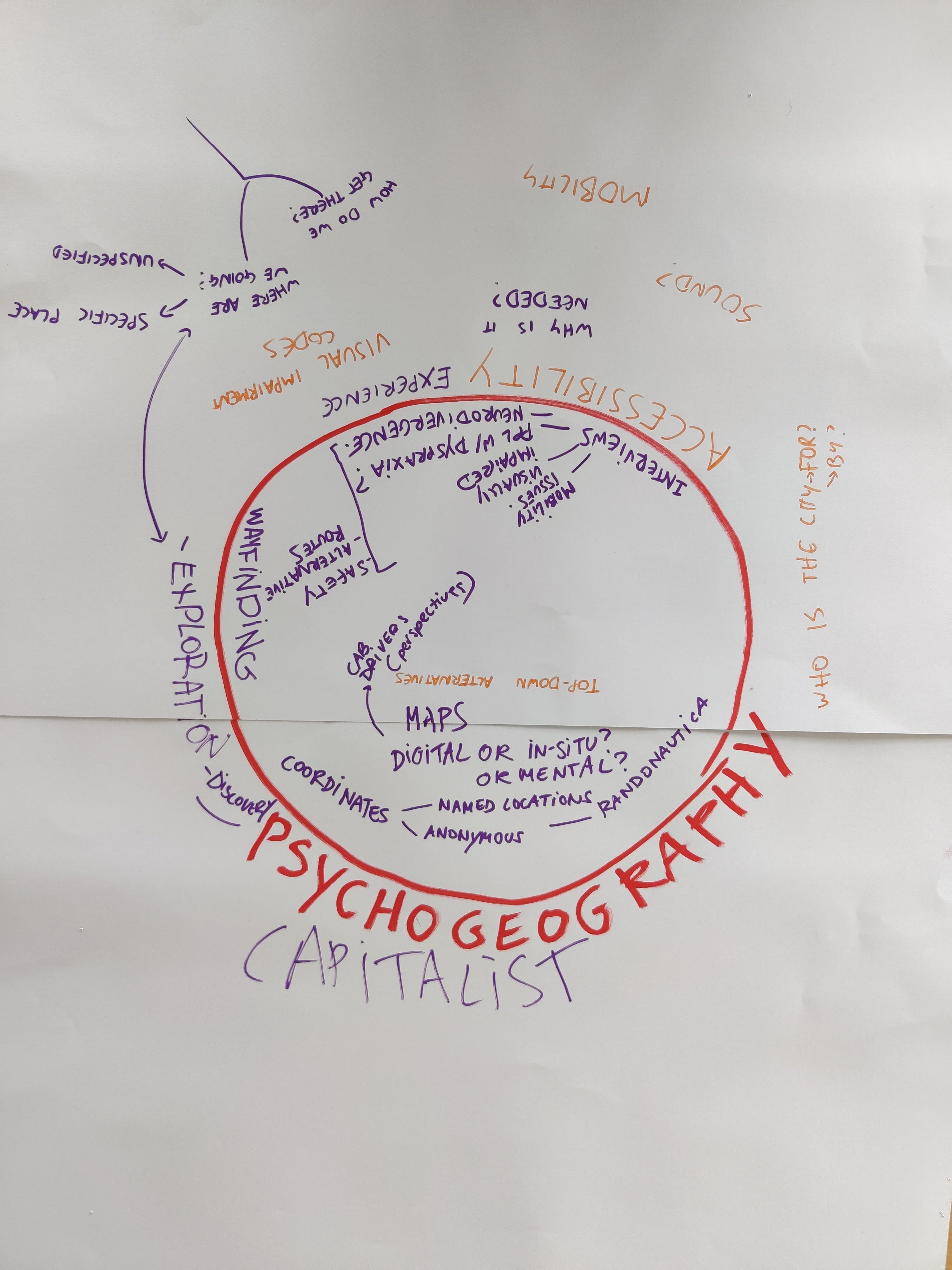
For the past three weeks, we’ve been beginning work on our FMP by creating some quick prototypes of ideas we’d like to work on. As me and Cristele have spoken previously about our topics of interest (which involve wayfinding and psychogeography), these weeks have allowed us to drill down into the tools and resources available to us going forward.
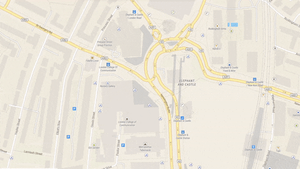
We knew we were both drawn to the idea of promoting urban exploration, and so we tested out an existing tool for this: Randonautica, which directs you to a random point in your given area. We walked to the identified location (a construction site in a council estate), aiming to navigate there without using navigation software.
As we felt this was a more informal research activity, we didn’t document this process, but in feedback we were reminded that any and all research would benefit from documentation. We resolved to be more comprehensive about this going forward.
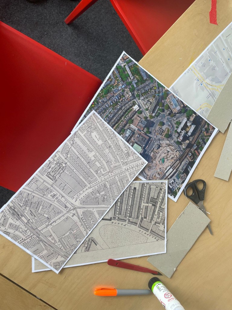
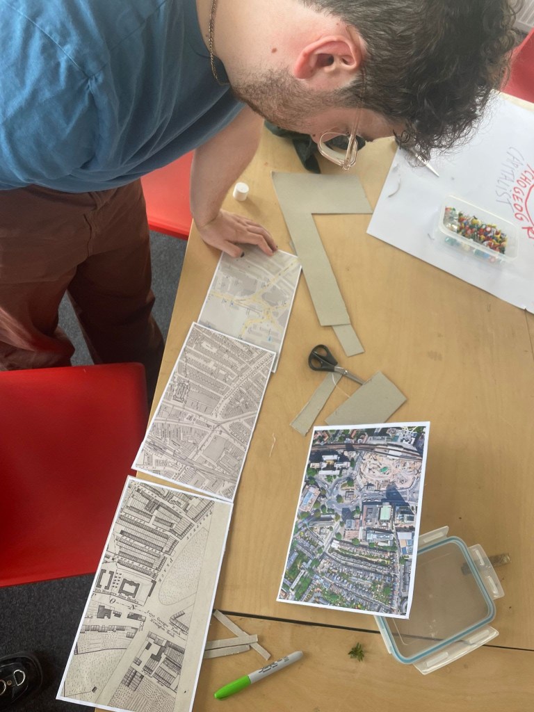
We also discovered a resource for combining maps across time: oldmapsonline.org, which aligns various maps automatically. We did this for Elephant and Castle to see how the area had changed over time – we were particularly interested in the way in which certain features had persisted or disappeared, and how it could be possible to navigate an area using tools from a different time period.
Physicalising these maps was less successful, as directly overlaying them in space was messy and difficult to correctly align. However, it underlined an aspect we would like to probe further: our disdain for top-down maps as tools of exploration, as they bear little immediate relationship to our experience of space. This was also apparent in our Randonautica adventures, where we felt that a co-ordinate point on a GPS map was a far too predetermined method for discovery, and eroded the concept of “stumbling across” that we want our design to preserve.
We received a lot of good feedback when we presented these prototypes:
- If we’re interested in psychogeography, there are key resources that ground this in wayfinding and navigation, such as Erik Jonsson and Iain Sinclair
- Our instinct to eschew top-down and GPS maps is one that seems a useful tool for proceeding with our design
- Perhaps there is room for us to think about psychological as well as physical spatial navigation – a taxonomy of wayfinding approaches could be a good way to begin formalising what we want to work on.
